I like being silly and listening to audiobooks while traipsing through the woods. Mostly in Massachusetts.
Saturday, August 26, 2017
Laguna de Santa Rosa Wetland Preserve
Location: Laguna de Santa Rosa Wetland Preserve
Managed by: Sonoma County Regional Parks
Trail: Pedestrian Trail, Laguna de Santa Rosa Trail
Distance: 2.29 mi
Trail Map
My aunt came and visited me and my mom with her dog, Rowdy! We went to dinner in Sebastopol and then went for this walk after. The sunset was absolutely gorgeous. The trails here are very flat and it's a beautiful spot for a walk.
The way the sunset lit up the fields was gorgeous!!
Rowdy approved.
Saturday, August 5, 2017
Point Reyes National Seashore
Location: Point Reyes National Seashore
Managed by: NPS
Trail: Mount Wittenberg Trail, Sky Trail, Meadow Trail, Bear Valley Trail
Distance: 6.91 miles
Trail Map
Followed the plan perfectly :)
Reid and I wanted to get in a good hike, and it was suuuper hot in Sonoma County, so we went out to Point Reyes, where the weather was much more agreeable! This hike was absolutely gorgeous. Quite steep, but at the top, it was super misty (as you can see in the photos), and the cool, misty air was kind of the best thing EVER. The "scenery" changed pretty dramatically several times during this hike. There were the towering trees, the short trees at the top with the misty air, grassy fields... It's a great hike and I highly recommend it!
Me being SUPER excited about the mist.
LOOK AT THE MIST!!!
Yep.
Look at the sun and the way the mist is obscuring the trees omg.
The mistiness makes it look snowy. And I'm creepy.
MISTBORN.
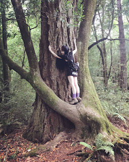
The little tree is hugging the big tree and I wanted to be a part of it.
This sign is at the beginning of the hike. We didn't see any horses, but... Good to know...
Trees at the beginning of the hike before the mist!
Friday, August 4, 2017
Salt Point State Park
Location: Salt Point State Park
Managed by: California Department of Parks and Recreation
Trail: Salt Point Trail, North Trail, Huckleberry Trail, Central Trail
Distance: 5.52 miles
Trail Map
Fairly easy to follow! I didn't have reception for the first few minutes of the hike, so I couldn't start the app (this explains the little gap between the starting and ending points).
Allyson and I went to Salt Point -- the first time for both of us! -- and did this beautiful hike on my second day back in California. It ruled. I think the pictures will speak for themselves.
Summary:
- $8 day use fee (or California State Parks Pass)
- Many trails aren't marked, but it's fairly easy to follow them if you have a map (and they give you one when you pay the fee)
This arch we stumbled upon is just the best.
Starfriend.
Another starfriend!
A wild PBR naturally-occurring-in-nature
Silly 4-ever
Silly 5-ever
Seafriends!
I kinda missed Allyson. A liiiittle bit, I guess.
Terrifying and v v dead lingcod next to some bear poop
Subscribe to:
Posts (Atom)