Saturday, August 26, 2017

Laguna de Santa Rosa Wetland Preserve


Location: Laguna de Santa Rosa Wetland Preserve
Managed by: Sonoma County Regional Parks
Trail: Pedestrian Trail, Laguna de Santa Rosa Trail
Distance: 2.29 mi
Trail Map


My aunt came and visited me and my mom with her dog, Rowdy! We went to dinner in Sebastopol and then went for this walk after. The sunset was absolutely gorgeous. The trails here are very flat and it's a beautiful spot for a walk.


The way the sunset lit up the fields was gorgeous!!


Rowdy approved.


Saturday, August 5, 2017

Point Reyes National Seashore


Location: Point Reyes National Seashore
Managed by: NPS
Trail: Mount Wittenberg Trail, Sky Trail, Meadow Trail, Bear Valley Trail
Distance: 6.91 miles
Trail Map

Followed the plan perfectly :)


Reid and I wanted to get in a good hike, and it was suuuper hot in Sonoma County, so we went out to Point Reyes, where the weather was much more agreeable! This hike was absolutely gorgeous. Quite steep, but at the top, it was super misty (as you can see in the photos), and the cool, misty air was kind of the best thing EVER. The "scenery" changed pretty dramatically several times during this hike. There were the towering trees, the short trees at the top with the misty air, grassy fields... It's a great hike and I highly recommend it!

Me being SUPER excited about the mist.


LOOK AT THE MIST!!!


Yep.


Look at the sun and the way the mist is obscuring the trees omg.


The mistiness makes it look snowy. And I'm creepy.


MISTBORN.


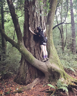
The little tree is hugging the big tree and I wanted to be a part of it.

This sign is at the beginning of the hike. We didn't see any horses, but... Good to know...


Trees at the beginning of the hike before the mist!


Friday, August 4, 2017

Salt Point State Park


Location: Salt Point State Park
Managed by: California Department of Parks and Recreation
Trail: Salt Point Trail, North Trail, Huckleberry Trail, Central Trail
Distance: 5.52 miles
Trail Map

Fairly easy to follow! I didn't have reception for the first few minutes of the hike, so I couldn't start the app (this explains the little gap between the starting and ending points).


Allyson and I went to Salt Point -- the first time for both of us! -- and did this beautiful hike on my second day back in California. It ruled. I think the pictures will speak for themselves.

Summary:

  • $8 day use fee (or California State Parks Pass)
  • Many trails aren't marked, but it's fairly easy to follow them if you have a map (and they give you one when you pay the fee)

This arch we stumbled upon is just the best. 

Starfriend.

Another starfriend!

A wild PBR naturally-occurring-in-nature


Silly 4-ever

Silly 5-ever


Seafriends!


I kinda missed Allyson. A liiiittle bit, I guess. 


Terrifying and v v dead lingcod next to some bear poop

Saturday, July 29, 2017

South Natick


Location: South Natick
Managed by: Town of Natick
Trail: Eisenmenger Trail, Sudbury Aqueduct Trail
Distance: 4.9 miles
Trail Map (Pay attention to the compass; north is not directly up on this map)

I chose to take a different trail for a little bit at the top on the way back, but otherwise followed it quite closely.


I'm housesitting and wanted to take the dog for a nearby hike. I went online and found this trail. It is sometimes in the woods, but sometimes in residential areas. It was perfect for a nice evening walk with Niko!

Summary:
  • A pleasant hike if you live in this area; not one to seek out
  • Sometimes the trails are marked clearly, sometimes they're not. Either bring a map, or just wander around -- it's hard to get lost when there are paved roads not far off in every direction. 
  • There are a TON of bugs out here. I wore a permethrin treated mesh head net because there are THAT MANY tiny flies and bugs. 

The Sudbury Aqueduct Trail is really pretty. I want to explore more of it! Today, I just used it as a brief connector trail. 

Niko is clearly a fan. 


This was, of course, my favorite part! 

Cute little bench/bridge along the trail. 

The baseball field at the top end of the hike! 

Thursday, July 27, 2017

Ravenswood Park

Location: Ravenswood Park
Managed by: TTOR
Trail: Fernwood Lake Trail, Magnolia Swamp Trail, Ledge Hill Trail, Boulder Field Trail, Buswell Trail, Old Salem Road
Date: 7/27/17
Distance: 6.24 miles

Aside from an intentional deviation up by Fernwood Lake and another at the start of the Magnolia Swamp Trail (yellow), I pretty much followed the plan perfectly.


This hike started off a little confusing for me. I put "Ravenswood Park" into my GPS, and it took me to the gate on Quarry Road. I wasn't paying attention, so I didn't realize this, and assumed it had taken me to the actual parking area (if you look on the trail map linked above, it's just below marker 1 where the yellow and orange trails meet). Because I didn't notice that I wasn't at the regular parking area (you can park at Quarry Road as well, though there's only room for 2-3 cars), I thought I was at a different point on the trail map, and wondered why I came right to marker 12 and then 21, instead of 1 and then 3... Figured it out quickly, thanks to the number markers and color marked trails!
I HIGHLY recommend making the little extra loop I made up at Fernwood Lake. The trails I took are not on the trail map at all, but they are maintained and clear. The view across the lake is absolutely gorgeous, and you don't get to see the lake *at all* if you stick to the blue trail. This is like, a straight-up tragedy. It's SO beautiful, why would you want to hike SO close to it and not even see it?? Do it.
When I got to the Magnolia Swamp Trail (yellow), there was a gorgeous boardwalk going out into the swamp in the direction I wasn't planning on going... So I walked out on it for a little bit and then turned around when the boardwalk ended and resumed my planned hike. If you're into boardwalks, I recommend this too!
I can't say enough about how pretty this little hidden gem of a park is.

Summary:

  • Either set a pin for the main entrance in your GPS, or know that Google will probably take you to this alternate entrance. 
  • Dog friendly (strictly on-leash; there are vernal pools)
  • If you immediately spot the typo on the Trail Map, we should be friends.

This is what you'll miss if you don't make the little loop up through Fernwood Lake. 


Magnolia Swamp Trail (magical, duh)


So many rocks at this park! Almost made me feel like I was in California again... Next week! 


Vernal pool

I saw a million frogs. Big ones & little ones! Tonsssss of little friends! 

On the website, the Ledge Hill Trail is described as featuring "magical-looking, fern-covered boulders." I cannot disagree with this assessment. 


Trees are crazy.