Location: Mount Greylock State Reservation
Managed by: DCR
Trail: Jones Nose Trail, Appalachian Trail, Old Adams Road
Date: 10/9/17
Distance: 11.25 miles
Trail Map
The original planned hike is in pink, and the addition that we decided on mid-hike is in blue! The map was very easy to follow and the trails are well marked.

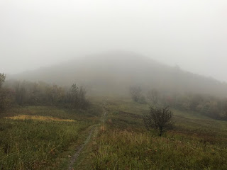
Fall break! I went to Western Mass to hang out and hike with my friend Cassandra. We wanted to get in a good hike while I was there, so despite the rain, we headed to Mount Greylock! We planned to just do the Jones Nose Trail/Old Adams Rd loop, but when we got to the upper point of the triangle, we did not feel ready to head back just yet, so we decided to keep going... Next thing we knew, we were a mile short of the summit, and decided to just do it. The rain was INSANE. Torrential downpour! We looked & felt like drowned possums. Anyway, it's an absolutely gorgeous and really fun hike. I highly recommend it!
Summary:
- Dog friendly!
- No parking fee
- Well marked trails
- Just go. Worth it.
Before getting completely dumped on by the sky (photo by Cassandra)


Cassandra at an Appalachian Trail marker!

I did not yet know what I was in for.


x-treme picture taking pose


Yeah... So at this point it was raining pretty hard.


SO MUCH WATER

SUMMIT!
"From the summit, views of up to 72 mi (116 km) are possible into five different states: Massachusetts, New York, Connecticut, Vermont, and New Hampshire." Ok cool, we wouldn't know.


Looking back just before the end of the hike.

We were maybe the only ones crazy enough to be out there at this point.

No comments:
Post a Comment