Saturday, July 29, 2017

South Natick


Location: South Natick
Managed by: Town of Natick
Trail: Eisenmenger Trail, Sudbury Aqueduct Trail
Distance: 4.9 miles
Trail Map (Pay attention to the compass; north is not directly up on this map)

I chose to take a different trail for a little bit at the top on the way back, but otherwise followed it quite closely.


I'm housesitting and wanted to take the dog for a nearby hike. I went online and found this trail. It is sometimes in the woods, but sometimes in residential areas. It was perfect for a nice evening walk with Niko!

Summary:
  • A pleasant hike if you live in this area; not one to seek out
  • Sometimes the trails are marked clearly, sometimes they're not. Either bring a map, or just wander around -- it's hard to get lost when there are paved roads not far off in every direction. 
  • There are a TON of bugs out here. I wore a permethrin treated mesh head net because there are THAT MANY tiny flies and bugs. 

The Sudbury Aqueduct Trail is really pretty. I want to explore more of it! Today, I just used it as a brief connector trail. 

Niko is clearly a fan. 


This was, of course, my favorite part! 

Cute little bench/bridge along the trail. 

The baseball field at the top end of the hike! 

Thursday, July 27, 2017

Ravenswood Park

Location: Ravenswood Park
Managed by: TTOR
Trail: Fernwood Lake Trail, Magnolia Swamp Trail, Ledge Hill Trail, Boulder Field Trail, Buswell Trail, Old Salem Road
Date: 7/27/17
Distance: 6.24 miles

Aside from an intentional deviation up by Fernwood Lake and another at the start of the Magnolia Swamp Trail (yellow), I pretty much followed the plan perfectly.


This hike started off a little confusing for me. I put "Ravenswood Park" into my GPS, and it took me to the gate on Quarry Road. I wasn't paying attention, so I didn't realize this, and assumed it had taken me to the actual parking area (if you look on the trail map linked above, it's just below marker 1 where the yellow and orange trails meet). Because I didn't notice that I wasn't at the regular parking area (you can park at Quarry Road as well, though there's only room for 2-3 cars), I thought I was at a different point on the trail map, and wondered why I came right to marker 12 and then 21, instead of 1 and then 3... Figured it out quickly, thanks to the number markers and color marked trails!
I HIGHLY recommend making the little extra loop I made up at Fernwood Lake. The trails I took are not on the trail map at all, but they are maintained and clear. The view across the lake is absolutely gorgeous, and you don't get to see the lake *at all* if you stick to the blue trail. This is like, a straight-up tragedy. It's SO beautiful, why would you want to hike SO close to it and not even see it?? Do it.
When I got to the Magnolia Swamp Trail (yellow), there was a gorgeous boardwalk going out into the swamp in the direction I wasn't planning on going... So I walked out on it for a little bit and then turned around when the boardwalk ended and resumed my planned hike. If you're into boardwalks, I recommend this too!
I can't say enough about how pretty this little hidden gem of a park is.

Summary:

  • Either set a pin for the main entrance in your GPS, or know that Google will probably take you to this alternate entrance. 
  • Dog friendly (strictly on-leash; there are vernal pools)
  • If you immediately spot the typo on the Trail Map, we should be friends.

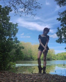
This is what you'll miss if you don't make the little loop up through Fernwood Lake. 


Magnolia Swamp Trail (magical, duh)


So many rocks at this park! Almost made me feel like I was in California again... Next week! 


Vernal pool

I saw a million frogs. Big ones & little ones! Tonsssss of little friends! 

On the website, the Ledge Hill Trail is described as featuring "magical-looking, fern-covered boulders." I cannot disagree with this assessment. 


Trees are crazy. 

Wednesday, July 26, 2017

Noon Hill Reservation


Location: Noon Hill Reservation
Managed by: TTOR
Trail: Yellow Loop, Blue Loop, Noon Hill Red Loop, Orange Loop
Date: 7/26/17
Distance: 6.24 miles
Trail Map

Followed the plan!


This was a very pleasant hike. I was feeling pretty grumpy and kept getting attacked by bugs (some large flying bug that looked like a dragonfly nymph kept biting me! painful, but didn't leave marks really), but it was still fun. The view when I got to the Noon Hill summit was really nice, but I only stayed for a minute because of this very persistent bug. I ran into two other groups of hikers, but for the majority of this hike, I had the trails to myself. There were some beautiful boardwalk sections. This is a reservation I'd love to hike in the rain. Also, I almost skipped the Orange Loop (around Holt Pond), but I'm really glad I didn't. It's really small, but beautiful.

Summary:
  • Dog friendly
  • Stayed super muddy from rain a day or two before

Sunset at the summit...

This is my hiking friend. He's hiked 30+ miles with me since Natasha gave him to me :D 


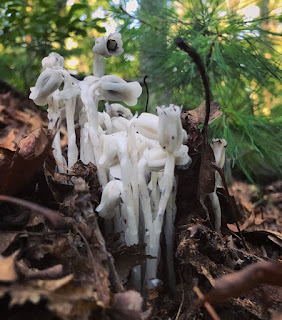
I found more ghost pipes!


I will never get tired of these boardwalks...

Holt Pond


Tuesday, July 25, 2017

Arlington's Great Meadows


Location: Arlington's Great Meadows
Managed by: Arlington
Trail: Unnamed
Date: 7/25/17
Distance: 3.67 miles
Trail Map

Here's what I hiked:


I didn't plan this hike much, because the trail map was a little unclear. I wanted to create a loop, but it looked like this conservation area is just a bunch of relatively short, disconnected trails. I was hoping that once I got there, I'd find that that wasn't the case. But... It is the case. However, you can exit the park and walk along a street in a residential area for a little while to resume the hike on the next trail. This is what I did -- you can see in the right lower half of the loop, I'm in a neighborhood instead of the park. There are tons of trails at this park, most unmarked. It's absolutely gorgeous. I saw tons of birds and bunnies. And other hikers/people walking their dogs. This is a really lovely place for a short, easy hike, when you just want to be surrounded by super beautiful stuff.


Summary:

  • Dog friendly
  • Just wander around... Not really a place where you need a trail map. 


Tuesday, July 18, 2017

Brooks Woodland Preserve


Location: Brooks Woodland Preserve
Managed by: TTOR
Trail: Yellow Loop & Blue Loop
Date: 7/18/17
Distance: 3.7 miles (on paper)
Trail Map

There was no cell service at this spot, so I can't show you the typical "tracking vs. plan" that I usually do. Here's what was planned:


This was my birthday hike! Not having cell service bummed me out because tracking my hike always makes me feel a lot safer, so I was glad to at least have a friend along, so I wouldn't feel totally freaked out if I lost the trail! We found this spot a little harder to navigate than most Trustees' properties that I have visited. The yellow and blue loops are themselves quite well marked, but between the parking area to the yellow loop, there are several trail options, and no markers to guide you. There were a bunch of white markers throughout the hike, but there's no corresponding white trail on the map. Even so, it was relatively easy to navigate. We did, unfortunately, miss the turn back toward the parking lot, and accidentally started the whole yellow loop over again! Man am I spoiled from tracking. There were a TON of bugs on this hike, and Genevieve got eaten alive by mosquitos. My bizarre mosquito immunity saved me yet again.

Summary:
  • No cell service
  • Dog friendly

Met another super sweet dog on this hike!


White trail markers that don't correspond to anything on the trail map.


Silly snapchat filter for sweat & bug covered girls.